Gratis verzending vanaf 59,99 euro.

Word lid van een gemeenschap van boekenliefhebbers van over de hele wereld en krijg een heleboel voordelen.
Gratis account aanmaken
Gratis bezorging met Zásilkovna boven 59.99 €
DPD koerier 5.49 €
DHL koeriersdienst 5.49 €
GLS koerier 4.99 €
DPD-punt 3.99 €
 Contact
 Hoe winkelen bij ons werkt
Help
Bezorging
DPD koerier 5.49 €
DHL koeriersdienst 5.49 €
GLS koerier 4.99 €
DPD-punt 3.99 €
Gratis bezorging met Zásilkovna boven 59.99 €
Winkelgids
Mijn account
▸
Leeg :-(
0
Gratis verzending vanaf 59,99 euro.
Taal
 Engels
Engels
Boek
Gebonden (paperback)
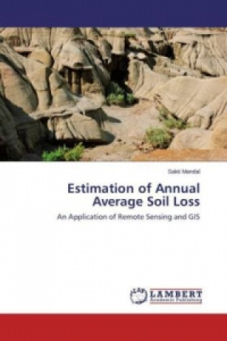
Remote Sensing (RS) and Geographic Information Systems (GIS) are useful tools in hydrological analys...
Volledige beschrijving
Libristo-code: 02201941
?
 86 b
86 b
86 b
35.87
€
In extern magazijn
Wordt binnen 5-8 dagen verzonden
Tot 30 dagen retourrecht
Klanten kochten ook

 /
/
 Gebonden (paperback)
 36.58
€
36.58
€

 /
Gebonden (paperback)
28.45
€
/
Gebonden (paperback)
28.45
€
 /
Gebonden (paperback)
70.63
€
/
Gebonden (paperback)
70.63
€





 /
Gebonden (paperback)
21.33
€
/
Gebonden (paperback)
21.33
€





 /
Gebonden (paperback)
9.04
€
/
Gebonden (paperback)
9.04
€


 /
Gebonden (paperback)
44.71
€
/
Gebonden (paperback)
44.71
€


 /
Gebonden (paperback)
50.61
€
/
Gebonden (paperback)
50.61
€
 /
Gebonden (paperback)
46.03
€
/
Gebonden (paperback)
46.03
€

Remote Sensing (RS) and Geographic Information Systems (GIS) are useful tools in hydrological analysis and natural resource management. The application of RS and GIS techniques leads to estimate soil loss based on different parameters. RUSLE (Revised Universal Soil Loss Equation) model is used for soil loss estimation. Different parameters, namely the rainfall and runoff factor (R), soil erodibility factor (K), slope length and steepness factor (LS), crop management factor (C) and conservation practice factor (P), that are the mandatory inputs to RUSLE, have been either derived from remote sensing data or through conventional data collection systems.
Actrice
&
Polyglot
EWA KASP
voor
Video afspelen


Libristo heeft de grootste selectie boeken in vreemde talen. Daarom koop ik mijn boeken hier.
Informatie over het boek
Volledige naam
Estimation of Annual Average Soil Loss
Auteur
Sakti Mandal
Taal
Engels
Engels
Bindwijze
Boek - Gebonden (paperback)
Datum van uitgifte
2013
Aantal pagina's
68
EAN
9783659466205
Libristo-code
02201941
Uitgeverij
LAP Lambert Academic Publishing
Gewicht
119
Afmetingen
150 x 220 x 4

Geef dit boek vandaag nog cadeau
Dat gaat heel eenvoudig
1 Voeg het boek toe aan je winkelwagentje en selecteer Als cadeau bezorgen 2 Je krijgt van ons per omgaand een voucher 3 Het boek wordt bezorgd op het adres van de ontvangerDit vind je misschien ook interessant
 /
Gebonden (paperback)
44.71
€
/
Gebonden (paperback)
44.71
€





 /
Gebonden (harde band)
32.82
€
/
Gebonden (harde band)
32.82
€

 /
Gebonden (harde band)
41.26
€
/
Gebonden (harde band)
41.26
€


 /
Gebonden (paperback)
12.19
€
/
Gebonden (paperback)
12.19
€

 /
Gebonden (paperback)
103.46
€
/
Gebonden (paperback)
103.46
€





 /
Gebonden (paperback)
21.33
€
/
Gebonden (paperback)
21.33
€